New publication - Tropical forest conversion to plantations increases below-canopy surface temperatures
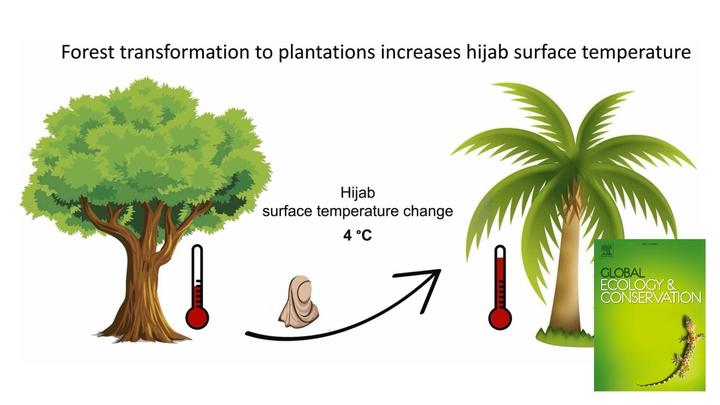
Land-use conversion from tropical forests to monoculture cash crop plantations such as rubber and oil palm has been associated with many adverse ecological effects including increases in air temperature and in land-surface temperatures. However, the effects of such land-use change on surface temperatures below the canopy, where many animals including humans pursue their activities, had previously not been systematically assessed. Led by researchers from the University of Göttingen, a collaborative international team studied canopy leaf area index and the below-canopy temperatures of different surfaces (ground, black-and-white board, workers’ cap and hijab) across 132 study plots in key land-use types in the lowlands of Sumatra (Indonesia), i.e. lowland rainforest, shrubland and rubber and oil palm plantations. We found that changes in leaf area index by tropical forest conversion to plantations increase below-canopy surface temperatures. For example, for a light-brown hijab as commonly worn by women in the region, the average noon surface temperature increased by 4.0 °C from forest (high leaf area index) to oil palm (low leaf area index). Thus, in addition to climatic warming, land transformation and associated declines in canopy leaf area index significantly increase below-canopy surface temperatures. Strategies for mitigating such potentially adverse temperature effects may include the integration of more and densely foliated trees into plantation landscapes.
Reference: Pallavi, Röll, A., Marques, I., Ramadhani, D.N., Valdes-Uribe, A., Hendrayanto, Hölscher, D. Changes in leaf area index by tropical forest transformation to plantations increase below-canopy surface temperatures. Global Ecology and Conservation 53 (2024): e03001. doi: https://doi.org/10.1016/j.gecco.2024.e03001
Dr. Alexander Röll
Researcher and lecturer
Hi, I am a forest ecologist strongly interested in agroforestry approaches, with a focus on hydrological research using ground-validated remote sensing applications from drones and satellites to study ecosystem structures, dynamics and key exchange processes across spatial scales, from single trees to regions.